In The Area
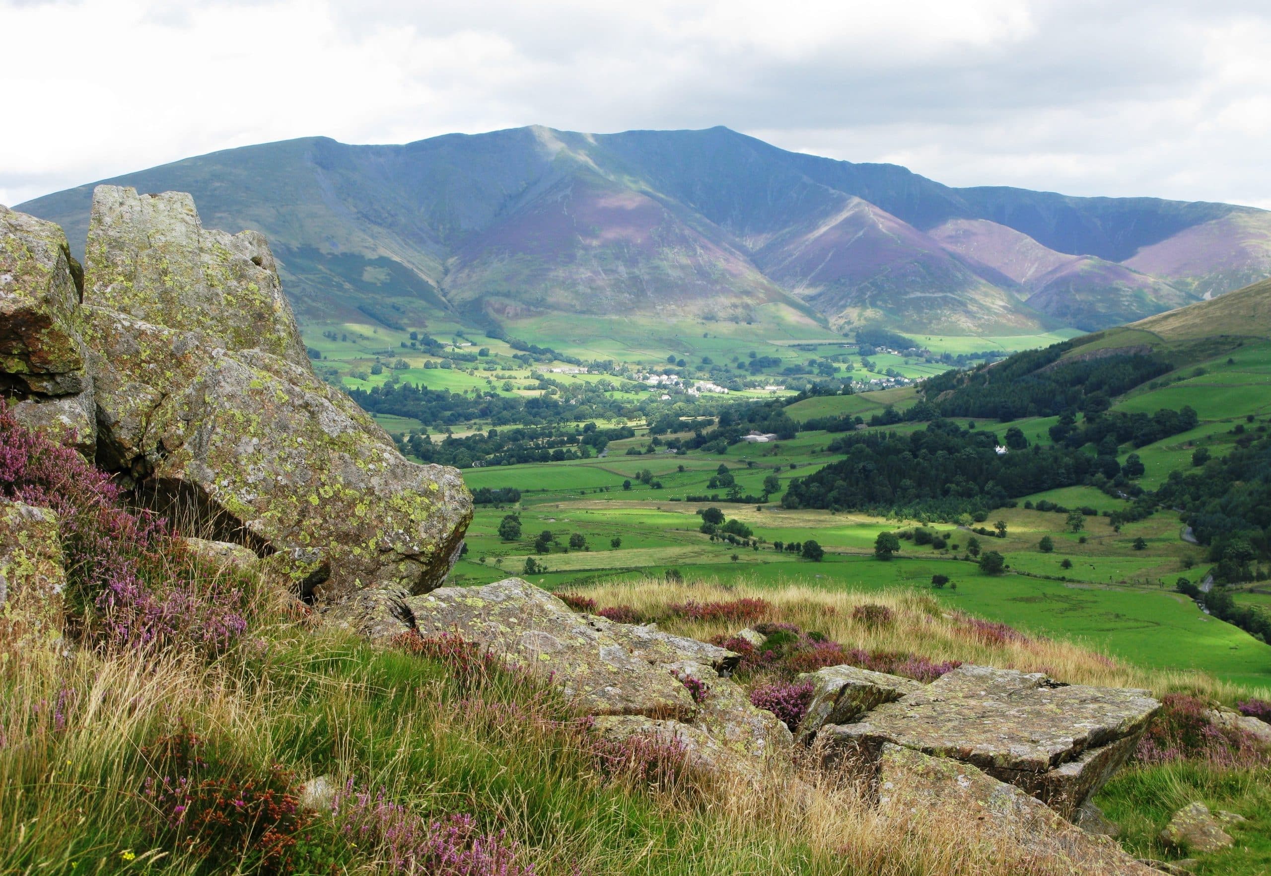
Threlkeld
Threlkeld is located just off the A66 between Penrith and Keswick, being only 3m west of Keswick. It lies on the south facing slopes of Blencathra (also known as Saddleback). To the south is Clough Head which is the northern end of the fells leading to Helvellyn. The village goes back at least 800 years. The name is Norse meaning the keld (spring or well) of the thralls, which is a feudal term for a man bound in service.
In Elizabeth I’s reign, there was extensive mining under Blencathra, chiefly of lead. The remains of workings can be seen in several places, especially at Gate Gill.
The village has 2 pubs, a coffee shop attached to the village hall and part-time Post Office, open Mondays, Tuesdays and Thursdays from 9:30am to 3:30pm.
There are walking (and some scrambling routes) up all the south facing ridges of Blencathra, where you will find a near flat summit ridge with extensive views to the north.
On the south side of Threlkeld lies the settlement of Threlkeld Quarry which is just below the granite quarry which opened just before the turn of the century.
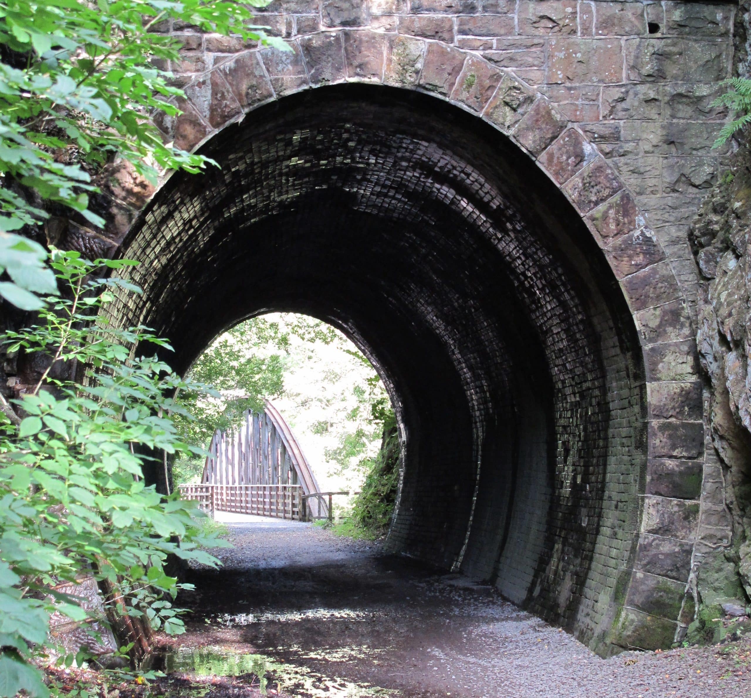
K2T: Keswick to Threlkeld Railway Path
The Cockermouth, Keswick Penrith railway opened in 1864 primarily for mineral transportation and then passengers. It closed in 1974 and the track was taken up. The route of this railway line from Threlkeld to Keswick is a very popular accessible for all walking and cycling route which follows the River Greta, crossing it several times. (Part of this route is included in one of the local walks for which directions are provided in this section). More information about this route can be found here.
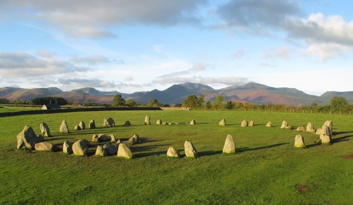
Castlerigg Stone Circle
Castlerigg Stone Circle is a short distance from Threlkeld towards Keswick. It takes a few minutes by car or you can walk there in about 45-60mins.
It’s one of the most visually impressive prehistoric monuments in Britain and the most visited stone circle in Cumbria. There are lovely views north of Blencathra and Skiddaw, south down St John’s in the Vale and west to Grisdale Pike and nearby hills. It’s very popular with photographers at sunrise and sunset.
There are 38 stones in a circle approximately 30metres in diameter with another 10 stones forming a rectangle inside. The tallest stone is 2.3m high. It was probably built about 3000BC at the beginning of the Neolithic Period. It is important in terms of megalithic astronomy and geometry and has some significant astronomical alignments. It’s origins and purpose are unknown but was probably for ceremonial or religious purposes.
The stone circle was bought in 1914 by Canon Hardwicke Rawnsley, co-founder of The National Trust. The stone circle is on land owned by the National Trust and is maintained by English Heritage.
Getting There: By Road
Leave Threlkeld at the West end (nearest Keswick) and turn right onto the A66, then immediately take the first turn left. Follow this road past Burns Farm and then take the second left at Naddle Bridge (about 1km after Burns Farm). A few hundred yards later turn left again, which is signposted to the stone circle. The stone circle is on your left in a field about 1km after the final left turn.
Getting There: By Foot
You can walk the road route as the lanes are quite quiet, or you can follow the railway line path from Threlkeld. After passing through the tunnel, you cross the river on a bridge. Just BEFORE the next bridge, there is a permissive footpath on the left which goes uphill to the A66, and through an underpass and then onto a B road. Turn left onto this road. After about 300yards, turn right then right again following the signs to the stone circle.
Local Low-Level Walks
These six varied walks in the vicinity of Threlkeld are reasonably straightforward and non-strenuous. Every care has been taken to test the routes in the series. However, walkers are responsible for their own safety when out in the countryside.
If you need a map, Ordnance Survey Explorer Outdoor Leisure 5 is best. Ensure you have reasonably sturdy footwear (all routes can be a bit muddy at times) and suitable clothing. Leave gates as you find them. Take your litter home with you. Keep dogs under close control always and on a lead in the lambing season (January-April).
All walks start and finish at the Village Hall main entrance. Timings are just a guide based on a steady pace; you could spend twice as long enjoying any one of them. You can get paper copies of the walk directions for a small donation in the Village Hall.
Download Walk Directions
- Walk 1: Fellside and Farmland (Easy 40mins)
- Walk 2: Woods, Fields and Old Railway Track (Easy 2hrs 15min)
- Walk 3: The Fell Wall Walk (Moderate 40mins)
- Walk 4: A Riverside Walk (Easy 30-60mins)
- Walk 5: A Stroll through Threlkeld Village (Easy 20mins)
- Walk 6: Riverside and Fellside (Moderate 2hrs 30mins)